M4.7 · 85 km W of Petrolia, CA
one catch · SS.OAKM1.00.EHZ
M4.7 · 85 km W of Petrolia, CA
2026-08-29 02:41:11 UTC · 318.6 km (NW) · depth 10.0 km
- magnitude
- 4.7
- distance
- 318.6 km
- depth
- 10.0 km
- envelope peak
- 19 µV
- envelope SNR
- 8×
- P predicted
- 45.7 s
- sustain
- 4.8 s
- low/high band
- 14.3×
- vs NP.1835
- 1.08×
P
S
Listen for how the pitch balance changes at the P wave (marked where it was picked), at the S wave (the dashed mark is its predicted arrival) and through the coda that follows. Volume is normalised to this clip, so it only says how much energy there is before, during and after the event relative to its own peak — not how big the earthquake was.
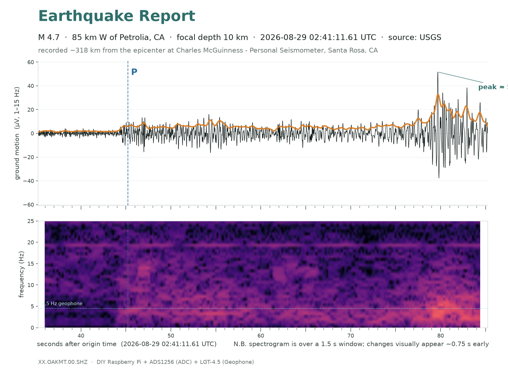
- The furthest catch by a factor of 3.6 — 319 km against a previous record of 89 km. Peak 52 µV, signal-to-noise ~27×, and energy above twice the noise floor for five minutes.
- Identified by the clock, not by amplitude. Pn was due at 02:41:56.7 (iasp91, 319 km, 10 km deep) and the detector triggered at 02:41:57.0; Sn was due at 02:42:32.1 and the envelope peaked at 02:42:31.7. Two independent arrivals, each inside half a second. It is also the only catalogued event within 700 km in a nine-minute window.
- This is what 319 km does to a signal. In the spectrogram every bit of the energy sits below ~7 Hz, hugging the geophone’s own 4.5 Hz corner — the crust has stripped everything above it out on the way. Its high/low band ratio is 0.40, where every other trigger that evening ran 1.2 to 3.3. Set it beside the M1.8 Santa Rosa, which arrived from 2.8 km with energy still present at 24 Hz: same instrument, same night, opposite ends of the same rule.
- The station said so at the time. The trigger classifier scored it p = 0.991 and pushed a notification 91 s after the P arrival; the follow-on trigger 32 s later scored 0.838 and was correctly swallowed by the five-minute hold-off, so one earthquake produced one alert.
- It is drawn on the range map above as a diamond but is not part of the calibration. It reads 16× below the textbook amplitude — past the cut the fit uses to throw out probable mis-associations — because what survives this far out is low-frequency Lg, the band a 4.5 Hz geophone is built to reject. Fitting it would make one far-field point the anchor for every ring on the map.
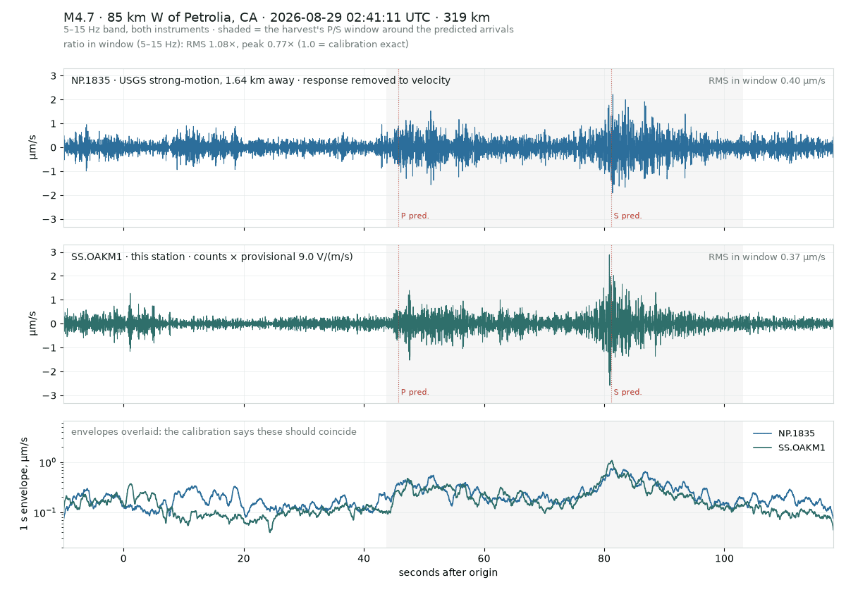
Side by side with USGS NP.1835, 1.64 km away, both in ground velocity.
Independent station. Times are UTC. Built by Charles McGuinness.